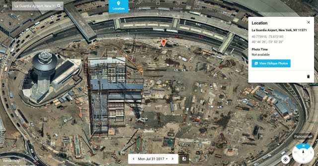
Service Provides Clear, Orthorectified and Current Images of Construction Site
Jeffrey Heimgartner posted on December 07, 2017 | 481 views
Satellite images can be used for space planning, site plans, design and analysis of existing and proposed sites, or to highlight areas and details of civil and large construction projects. More often than not, however, when using some of the more popular free satellite map and image applications available, the images we find are months, if not years, out of date.

Nearmap Panorama of LaGuardia Airport, New York, July 31, 2017 (Image courtesy of Nearmap)
That’s not the case with Nearmap, a location content provider specializing in high resolution aerial imagery. It captures images multiple times a year. Since they are aerial images as opposed to satellite images, the images aren’t affected by potential obstructions like weather or the atmosphere. Per its website, “Nearmap captures leaf-off and leaf-on aerial photos year-round under the best possible conditions.” It quickly processes images that are streamed to the cloud in a matter of days, where they are available for viewing and use on both desktops and mobile devices. This is accomplished through an innovative, powerful, patented imaging and processing technology.
Continuing with its innovation, Nearmap recently announced the release of new forms of location content—Nearmap Panorama and Nearmap Oblique—available through a new MapBrowser interface….

