InfraWorks Updates Build Bridge To Geographic Information Software
Emily Pollock posted on July 18, 2018 |

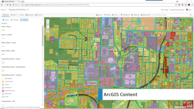
A model in Esri’s ArcGIS. The new Autodesk Connector lets Autodesk users import data directly from ArcGIS. (Image courtesy of Autodesk.)
Last week Autodesk released the year’s first InfraWorks update. Although the update focuses on improving the design experience and simplifying workflow, the most noteworthy new feature is a bridge between InfraWorks and Esri’s Geographic Information System (GIS) software, one of the first in-product fruits of the Autodesk and Esripartnership.
InfraWorks caters to architects and engineers building infrastructure projects, so there’s a natural link with the spatial and geographic capabilities of GIS. Last November, Esri and Autodesk announced that they were going to work together to bridge their products.
The updated InfraWorks contains Autodesk Connector, a tool that allows users to build an InfraWorks model with data published to Esri’s ArcGIS Online. The connector ensures that no spatial and geographic data is lost, and allows users to update the InfraWorks model easily when the original GIS data is updated.
According to Autodesk, the update will make it easier for architects and engineers to look at the big picture when designing. “Partnering with Esri is intended to combine the power of BIM and GIS mapping, which will enable our shared customers to build anything, anywhere,” said Autodesk CEO…

