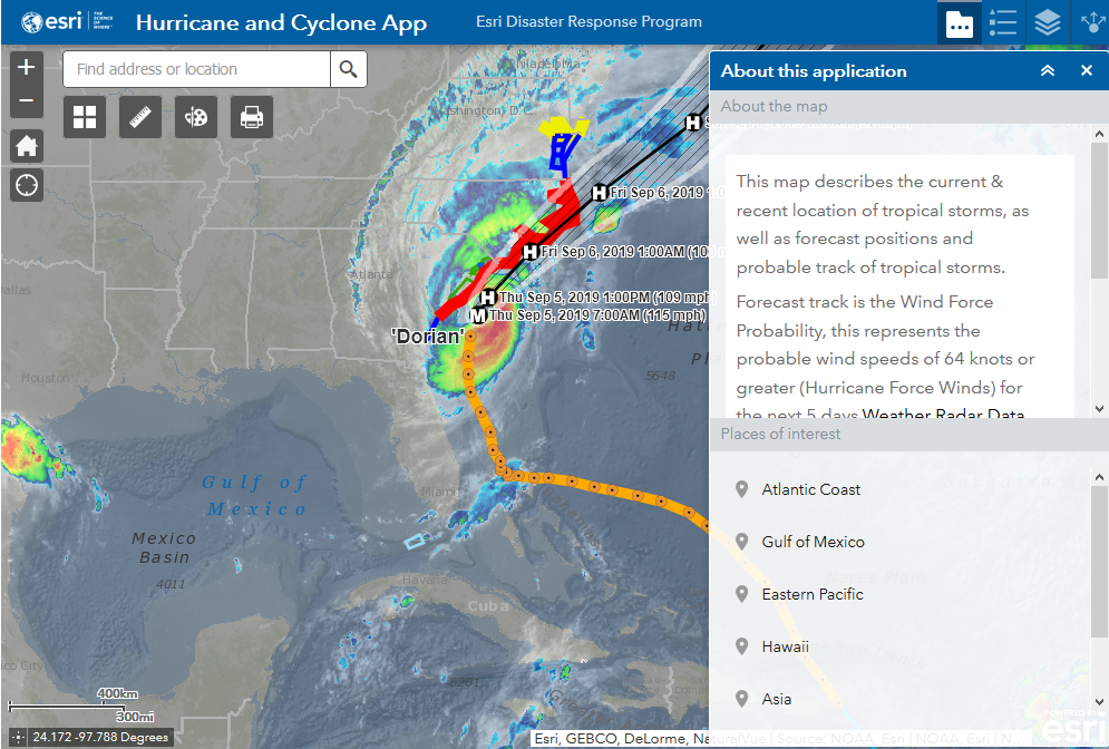
As the Southeastern United States keeps an eye on Hurricane, staff at Esri is utilizing their expertise in ArcGIS mapping software to provide resources through their Disaster Response Program (DRP).
Esri’s software is used to track and forecast positions of tropical storms and hurricanes. Through resources such as map layers, interactive maps, live feeds, how-to guides and reports, Esri can easily provide mission-critical information quickly and globally. They use GIS to quickly access and visualize information that is critical to locations affected by a disaster.
Did you know that during a disaster, Esri customers can temporarily extend your existing licenses to support increased GIS use during disaster response? This keeps you from worrying about losing access to your software, while providing workflow implementation, geospatial data and technical support to help users gain access to aid.
ArcGIS mapping software is a powerful tool that assists with many disaster response…