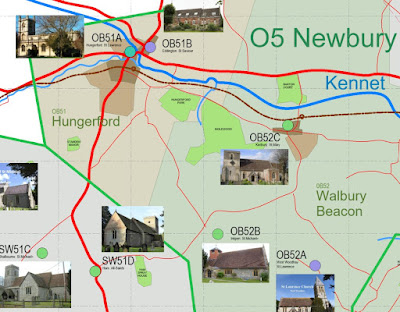
Top corner of sheet two. This is starting
to look quite useful. I don’t remember ever going to Hungerford, but definitely
worth a visit. They still have a “common” from medieval times.
There were several country estates in 1900,
different sizes, some with hunting forests attached. Memories of a very
different world. Lord of the manor, farming villages, the railway has arrived
like a whirlwind. Change is coming.
Hungerford lies at the junction of the
River Kennet and it’s tributary the Dun. Ultimately this water all flows East
through Reading then on to the Thames and London. The roads and the railway
follow the same route in parallel.
Due West lies Bath, with Bristol beyond.
Branch slightly South and you are heading to Somerset, Devon, Cornwall. I know
all this stuff, but it’s been coming to life more vividly as I work on the map
in Revit.
It’s taken a lot longer than expected, I
mean really a lot, lot longer. That’s OK, just as long as I keep learning…


