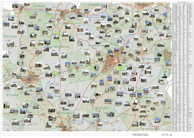
The upper half of my Hampshire Churches study area. The two kilometre grid is clear without
becoming obtrusive (Revit Halftone) Major roads are prominent and minor roads subdued.
Thick orange denotes modern highways and town bypass roads. One obvious mistake
on this export is the M3 from London to Southampton, (which skims the S.E. edge
of Basingstoke) is shown as a minor road.
Still a work in progress.
Also showing Rivers and streams which obviously affect
village placement. And starting to show country estates which are still quite
common, but much more so in 1900. I’m
showing the 19th century versions because along with the railways
this makes a fascinating record of a turning point in British history. There are also straight lines in dark red
which represent Roman roads. Lots of these,
giving time depth along with some thick red ellipses to represent Hill Forts,
presumably dating to pre-Roman times.
A section of the schedule which occupies the far right edge
of the…


