Typical workflow to acquire project coordinates that we use goes something like this:
1: Obtain Civil or Survey CAD file + Link it into Revit Project; this is typically the “Site” project, but can also be the “Main model” if you are not breaking out the Site in a separate file.
2: Move the CAD file into the proper location as it relates to the building; you can rotate, shift up down left right, etc., etc. – Important to note that you are looking to match a specific geodetic elevation associated within the CAD file to your main floor elevation in addition to the location of the building on the site.
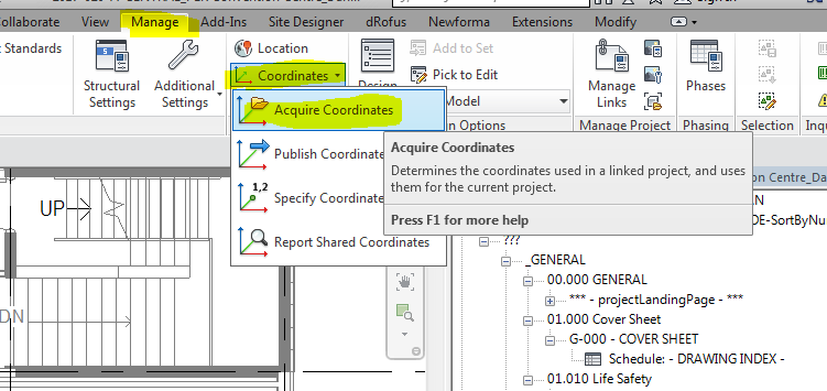
3: Acquire the coordinates of the CAD file – now your Revit model coordinates will match the Real World Coordinates that are (mostly) always associated with the survey file.
4: Next, provide your consultants with the Revit file that has acquired the CAD coordinates. Have them link it Center to Center, or something other than Shared coordinates.
5: Locate (move) the Linked model in…